|
||||
|
||||
|
![]()
![]()
![]()
![]()
![]()
![]()
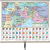
Wall Maps > Europe Political Map
-
Sale $114.99 - $699.99 (free shipping/handling) or 6 monthly installments with PayPal Credit Retail: $
180-995
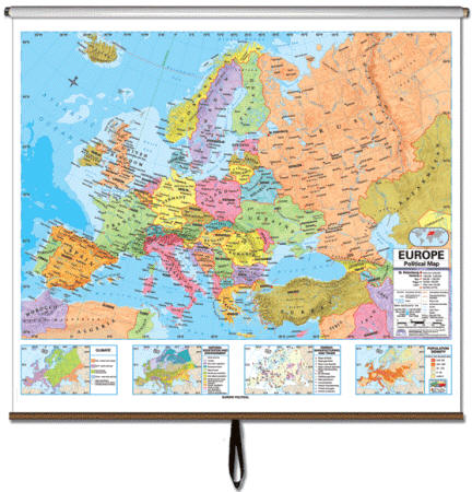
Europe - Political Classroom Wall Map on Roller
|
|
|
|||||||||||||||||||||||||||||
|
||||||||||||||||||||||||||||||
| Purchase Orders Accepted - U.S. educational institutions and government agencies can place orders via official purchase order. Please email your PO to traveler@1ststoptravelstore.com | ||||||||||||||||||||||||||||||
Wall Map Features:
The Europe Advanced Political Classroom
Wall Map features a wealth of valuable information, including country
and state boundaries, as well as capitals, major waterways, and major
cities.
Created with legibility in mind, this brightly colored
up to date
map highlight the continent with detailed cartography, is
easy to read,
printed on tough non-tear material, and is
markable.
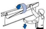
Map Setup
Options:
Appropriate for grades 6-12, satisfies state and national curriculum standards. This product is ideal for public, private, parochial, and home schools.
Call us toll-free 877-822-9889 or
812-333-2772 for orders/questions Mon.-Sat.
10:00 am-5:30 pm Eastern Standard Time
|
||||||||||||||||||||||||||||||
| US / World Combo Sets | World Wall Maps | USA Wall Maps | North America Map |
 |
 |
 |
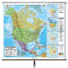 |
| $649.99-$749.99 (free s/h) | $114.99-$699.99 (free s/h) | $114.99-$699.99 (free s/h) | $114.99-$699.99 (free s/h) |
| Asia Wall Map | Africa Wall Map | Europe Wall Map | South America Map |
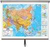 |
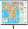 |
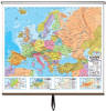 |
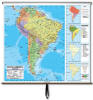 |
| $114.99-$699.99 (free s/h) | $114.99-$699.99 (free s/h) | $114.99-$699.99 (free s/h) | $114.99-$699.99 (free s/h) |
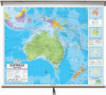
| Australia Wall Map | Central America Map | Middle East & S. Asia | |
 |
 |
 |
 |
| $114.99-$699.99 (free s/h) | $124.99-$699.99 (free sh/h) | $124.99-$699.99 (free sh/h) |
 |
Europe Wall Map by CM, Item #27941
Sale Price: $89.99 and up, Up-to-date Political Cartography, European Wall Map, Rolled Map, classroom wall map of Europe, European pull down wall map