|
||||
|
||||
|
Replogle Globes
|
Replogle Globes Background Replogle Globes was founded in 1930 by Luther Irwin Replogle. Originally located in Chicago, Illinois, we developed the concept of "a globe in every home." In 1959, the Company was purchased by Meredith Publishing Company, Des Moines, Iowa and sold in 1973 to the William C. Nickels Family, the present owners. Mr. Nickels progressively changed the founder's concept to "a globe for every room." The Company was founded to create globes for use in homes, with mountings compatible with home furnishings. Luther Irwin Replogle believed a globe in the home would make it easier to learn correct geographical relationships, since a globe is the only means of showing relative size and position of land masses and water areas correctly (all flat maps are distorted). In the early days, most globes were made for schools and other institutional uses. Now Replogle Globes is recognized worldwide as a "Globe Specialist" and "Leader" in the globe-making industry. |
|
Our World Globes
|
The Company produces and distributes hundreds of different globe models in 3.3", 4.2", 4.7", 6", 9", 10", 12", 16", 20" and 32" diameters. About 50% of all globes manufactured are 12 inches in diameter, which is considered the standard size for a home or schoolroom. The Company distributes globes through many different sales channels. The maps on all Replogle Globes show nations, colonies, possessions, boundary lines and place names as officially approved by the United States Government. Maintenance of the content of these maps requires frequent communication with various government agencies. These agencies include the U. S. Department of State, the U. S. Board of Geographic Names, the Central Intelligence Agency and the National Imagery and Mapping Agency. In addition to the sources listed above, we communicate with embassies of other nations in Washington D.C. and foreign consulate offices in Chicago (Replogle® Globes Inc. is headquartered in the Chicago area) for help with new changes in boundaries and place names. We also use material from official foreign place-name agencies equivalent to our U. S. sources. Like most American map makers, our globes show the de facto status of nations, regions and possessions-that is, the actual current political situation, or the way things are, not the way some factions believe the situations should be. In some regions we note the political claims by neighboring nations, but the land color (and border) is shown in accordance with the region's actual political affiliation or status. Due to our globe's use as a reference source for geographic places noted in contemporary news and historical literature, we often show alternative or former place names in parentheses. This
is one way our globes serve the ongoing needs of both the serious student and the casual user. |
Reference Guide
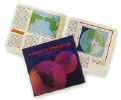
Included with most Replogle globes, is Guide to Your Globe booklet, a reference guide filled with fascinating facts about the history of globes and globe-making, a glossary of cartographic terms, and a fun quiz to check your knowledge of world geography. |
Call us toll-free 1(877) 822-9889 Monday-Saturday 10:00 am-5:30 pm with questions about World Globes


