|
||||
|
||||
|
|
||||
|
||||
|
| World Maps | Australia | Middle East |
| USA | Central America | Canada |
| Africa | North America | US History Maps |
| Antarctica | South America | World History Maps |
| Asia | Europe |
![]() Made in United States
Made in United States
World Maps - 64"W x 54"H |
|
|
|
Item # KP27891 The World Advanced Political Boundaries Classroom Wall Map (offers a wealth of valuable information, including continents, individual country boundaries, capitals, major cities and waterways, and the latest international name changes. Created with legibility in mind, this brightly colored up to date map highlight the world with detailed cartography, is easy to read, printed on tough non-tear material, and is markable. Mounted on roller and offered with or without backboard support. Appropriate for grades 6-12, and satisfying state and national curriculum standards, the Advanced Political Classroom Wall Map is a must-have for every classroom. Wall map is ideal for public, private, parochial, and home schools. Order Custom Wall Map Set here
|
|
|
Item #
KP28463 The World Essential Classroom Wall Map includes special polar projections. National capitals and major cities are identified. Shaded relief highlights physical features of the continent. Essential world wall map is mounted on roller; the Essential Series features an enhanced legend and pictorial landform illustrations for intermediate level use. Also shows deserts & wetlands. The inset map locator illustrates the location of each continent in the world. Appropriate for grades 4-8. This product is ideal for public, private, parochial, and home schools. Order Custom Wall Map Set here
|
|
|
Item #
KP11783 The World Primary Classroom Wall Map (with flags) includes special polar projections. National capitals and major cities are identified. Shaded relief highlights physical features of the continent. 193 country flags and more. Primary world wall map is mounted on roller; the Continent Essential Series features an enhanced legend and pictorial landform illustrations for intermediate level use. Also shows deserts & wetlands. The inset map locator illustrates the location of each continent in the world. Appropriate for grades 4-8. This product is ideal for public, private, parochial, and home schools. Order Custom Wall Map Set here
|
|
|
Item #
KP27823 Beginner classroom wall maps are ideal for pre-K through first grade, featuring bright colors with easy-to-identify land masses and major bodies of water. The World edition identifies only continents and oceans. Measures 64" x 54" and mounted on roller. This product is ideal for public, private, parochial, and home schools.
Order Custom Wall Map Set here
|
|
|
Item # KP27885 The World Advanced Physical Classroom Wall Map includes insets of Annual Rainfall, Energy-Manufacturing-Trade, Population Density, and Natural Vegetation and Environment. Featuring innovative shaded relief detail, this high quality series is appropriate for grades 6-12, and includes content that meets national and state curriculum standards. Four thematic inset maps enhance the value of the main map. Created with legibility in mind, this up to date map highlight the continent with detailed cartography, is easy to read, printed on tough non-tear material, and is markable. Mounted on roller and offered with or without backboard support. Ideal for public, private, parochial, and home schools. Order Custom Wall Map Set here
|
Call us toll-free 877-822-9889 or 812-333-2772 for orders/questions Mon.-Sat. 10:00 am-5:30 pm Eastern Standard Time
USA Maps - 64"W x 54"H |
|
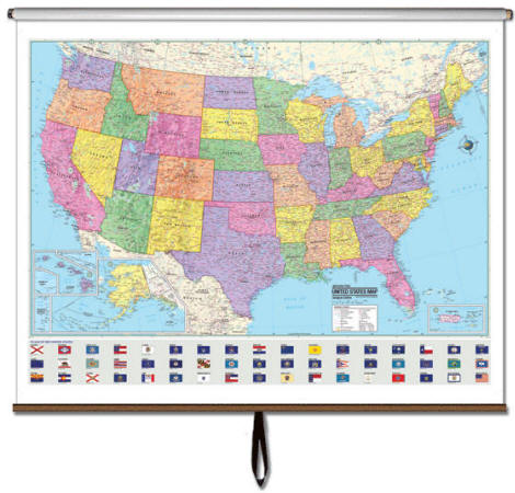 |
Item # KP27904 Wall Map Features: The US Advanced Political Boundaries Classroom Wall Map features a wealth of valuable information, including country and state boundaries, as well as capitals, major waterways, and major cities. Created with legibility in mind, this brightly colored up to date map highlight the continent with detailed cartography, is easy to read, printed on tough non-tear material, and is markable. Mounted on roller and offered with or without backboard support. Appropriate for grades 6-12, satisfies state and national curriculum standards. This product is ideal for public, private, parochial, and home schools. Order Custom Wall Map Set here
|
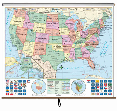 |
Item # KP28453 The US Essential Classroom Wall Map clearly identifies state capitals, time zones, and features insets of Alaska & Hawaii as well as all 50 state flags. Wall Map is mounted on a roller. The US Essential wall map features an enhanced legend and pictorial landform illustrations. This wall map is laminated so you can write on and wipe off with a dry erase or water soluble marker. Order Custom Wall Map Set here
|
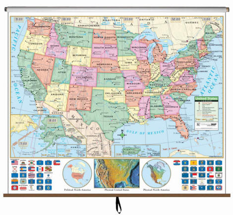 |
Item # KP15063 The United States Primary Classroom Wall Map features updated, full-color cartography with political boundaries, capitals, major cities and more. Mounted on roller. Order Custom Wall Map Set here
|
 |
Item # KP27897 The USA Advanced Physical Classroom Wall Map includes insets of Annual Rainfall, Energy-Manufacturing-Trade, Population Density, and Natural Vegetation and Environment. Featuring innovative shaded relief detail, this high quality series is appropriate for grades 6-12, and includes content that meets national and state curriculum standards. Four thematic inset maps enhance the value of the main map. Created with legibility in mind, this up to date map highlight the continent with detailed cartography, is easy to read, printed on tough non-tear material, and is markable. Mounted on roller and offered with or without backboard support. Ideal for public, private, parochial, and home schools. Order Custom Wall Map Set here
|
|
Individual US State Maps and Regional Maps
|
Please call toll free 877-822-9889
|
Call us toll-free 877-822-9889 or 812-333-2772 for orders/questions Mon.-Sat. 10:00 am-5:30 pm Eastern Standard Time
North America Maps - 64"W x 54"H |
|
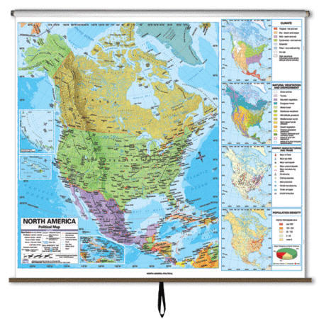 |
Item # KP27953 The North America Advanced Political Boundaries Classroom Wall Map ofers a wealth of valuable information, including country and state boundaries, as well as capitals, major waterways, and major cities. Created with legibility in mind, this brightly colored up to date map highlight the continent with detailed cartography, is easy to read, printed on tough non-tear material, and is markable. Mounted on roller and offered with or without backboard support. Appropriate for grades 6-12, satisfies state and national curriculum standards. This product is ideal for public, private, parochial, and home schools. Order Custom Wall Map Set here
|
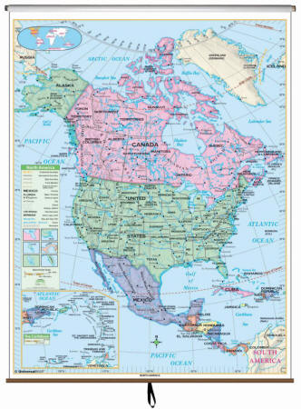 |
Item # KP28543 The North America Essential Classroom Wall Map includes Greenland, Alaska, Canada, the Continental United States, Mexico, and Central America. Also includes an inset map of the Greater and Lesser Antilles. Shaded relief highlights physical features of the continent Map will be printed on 64"W by 54"H sheet to match all other maps in the custom made map-set. Order Custom Wall Map Set here
|
 |
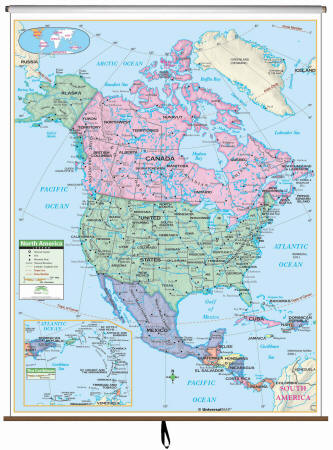
Item # KP27947 The North America Advanced Physical Classroom Wall Map includes insets of Annual Rainfall, Energy-Manufacturing-Trade, Population Density, and Natural Vegetation and Environment. Featuring innovative shaded relief detail, this high quality series is appropriate for grades 6-12, and includes content that meets national and state curriculum standards. Four thematic inset maps enhance the value of the main map. Created with legibility in mind, this up to date map highlight the continent with detailed cartography, is easy to read, printed on tough non-tear material, and is markable. Mounted on roller and offered with or without backboard support. Ideal for public, private, parochial, and home schools. Order Custom Wall Map Set here
|
|
Item # KP24381 The North America Primary Classroom Wall Map by Universal Map has a laminated and markable-washable surface. Features color-coded countries. Map will be printed on 64"W by 54"H sheet to match all other maps in the custom made map-set. Order Custom Wall Map Set here
|
Call us toll-free 877-822-9889 or 812-333-2772 for orders/questions Mon.-Sat. 10:00 am-5:30 pm Eastern Standard Time
Africa Maps - 64"W x 54"H |
|
 |
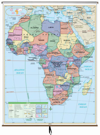
Item # KP27917 The Africa Advanced Political Boundaries Classroom Wall Map features a wealth of valuable information, including country and state boundaries, as well as capitals, major waterways, and major cities. Created with legibility in mind, this brightly colored up to date map highlight the continent with detailed cartography, is easy to read, printed on tough non-tear material, and is markable. Mounted on roller and offered with or without backboard support. Appropriate for grades 6-12, satisfies state and national curriculum standards. This product is ideal for public, private, parochial, and home schools. Order Custom Wall Map Set here
|
 |
Item # KP27911 The Africa Advanced Physical Classroom Wall Map includes insets of Annual Rainfall, Energy-Manufacturing-Trade, Population Density, and Natural Vegetation and Environment. Featuring innovative shaded relief detail, this high quality series is appropriate for grades 6-12, and includes content that meets national and state curriculum standards. Four thematic inset maps enhance the value of the main map. Created with legibility in mind, this up to date map highlight the continent with detailed cartography, is easy to read, printed on tough non-tear material, and is markable. Mounted on roller and offered with or without backboard support. Ideal for public, private, parochial, and home schools. Order Custom Wall Map Set here
|
 |
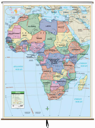
Item # KP28493 The Essential Series features an enhanced legend and pictorial landform illustrations for intermediate level use. Also shows deserts & wetlands. The inset map locator illustrates the location of each continent in the world. Appropriate for grades 4 – 8. This product is ideal for public, private, parochial, and home schools. Map will be printed on 64"W by 54"H sheet to match all other maps in the custom made map-set. Order Custom Wall Map Set here
|
|
Item # KP24373 Primary Wall Map of the African Continent ranges North to the Mediterranean Sea and Saudi Arabia; South to the Indian and Atlantic Oceans; East to the Indian Ocean and Madagascar; and West to the Atlantic Ocean. Also featured are elevations, national capitals, boundaries, and more. Mounted on roller. Map will be printed on 64"W by 54"H sheet to match all other maps in the custom made map-set. Order Custom Wall Map Set here
|
Call us toll-free 877-822-9889 or 812-333-2772 for orders/questions Mon.-Sat. 10:00 am-5:30 pm Eastern Standard Time
Asia - 64"W x 54"H |
|
 |
Item # KP27929 The Asia Advanced Political Boundaries Classroom Wall Map features a wealth of valuable information, including country and state boundaries, as well as capitals, major waterways, and major cities. Created with legibility in mind, this brightly colored up to date map highlight the continent with detailed cartography, is easy to read, printed on tough non-tear material, and is markable. Mounted on roller and offered with or without backboard support. Appropriate for grades 6-12, satisfies state and national curriculum standards. This product is ideal for public, private, parochial, and home schools. Order Custom Wall Map Set here
|
 |
Item # KP27923 The Asia Advanced Physical Classroom Wall Map includes insets of Annual Rainfall, Energy-Manufacturing-Trade, Population Density, and Natural Vegetation and Environment. Featuring innovative shaded relief detail, this high quality series is appropriate for grades 6-12, and includes content that meets national and state curriculum standards. Four thematic inset maps enhance the value of the main map. Created with legibility in mind, this up to date map highlight the continent with detailed cartography, is easy to read, printed on tough non-tear material, and is markable. Mounted on roller and offered with or without backboard support. Ideal for public, private, parochial, and home schools. Order Custom Wall Map Set here
|
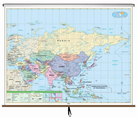 |
Item # KP28513 The Asia Essential Classroom Wall Map includes physical features and political boundaries, national capitals, cities, major waterways, and longitude/latitude lines. Shaded relief highlights physical features of the continent. Wall map is mounted on roller; features an enhanced legend and pictorial landform illustrations for intermediate level use. Also shows deserts & wetlands. The inset map locator illustrates the location of each continent in the world. Appropriate for grades 4-8. Order Custom Wall Map Set here
|
|
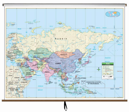
Item # KP24393 This Asia Primary Classroom Wall Map by Universal Map features laminated surfacing which is markable and washable, color coded countries. Ranges: North: to the Barents Sea and the Arctic Ocean; South: to Indonesia; East: to the East Bering Sea, Pacific Ocean; West: to Ukraine, Turkey. Details include national capitals, national boundaries, Tropic of Cancer, cities, latitude and longitude lines, Equator, mountain peaks, and the Date Line. Mounted on roller. Order Custom Wall Map Set here
|
Call us toll-free 877-822-9889 or 812-333-2772 for orders/questions Mon.-Sat. 10:00 am-5:30 pm Eastern Standard Time
South America - 64"W x 54"H |
|
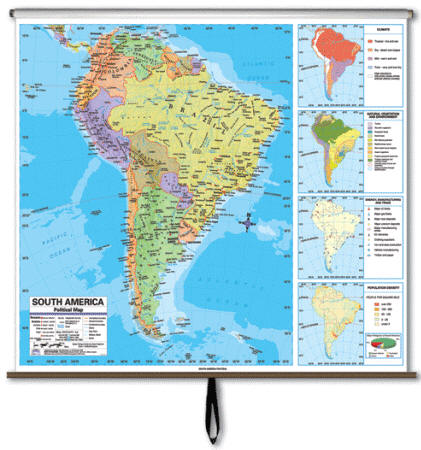 |
Item # KP27965 The South America Advanced Political Boundaries Classroom Wall Map offers a wealth of valuable information, including country and state boundaries, capitals, major waterways, and major cities. Features four insets: Climate; Energy, Manufacturing, and Trade; Population Density; and Natural Vegetation and Environment. Brightly colored up-to-date map highlight the continent with detailed cartography, is easy to read, printed on tough non-tear material, and is markable. Mounted on roller. Appropriate for grades 6-12, satisfies state and national curriculum standards. Order Custom Wall Map Set here
|
 |
Item #
KP27959 The South America Advanced Physical Classroom Wall Map includes insets of Annual Rainfall, Energy-Manufacturing-Trade, Population Density, and Natural Vegetation and Environment. Featuring innovative shaded relief detail, this high quality series is appropriate for grades 6-12, and includes content that meets national and state curriculum standards. Four thematic inset maps enhance the value of the main map. Created with legibility in mind, this up to date map highlight the continent with detailed cartography, is easy to read, printed on tough non-tear material, and is markable. Mounted on roller. Order Custom Wall Map Set here
|
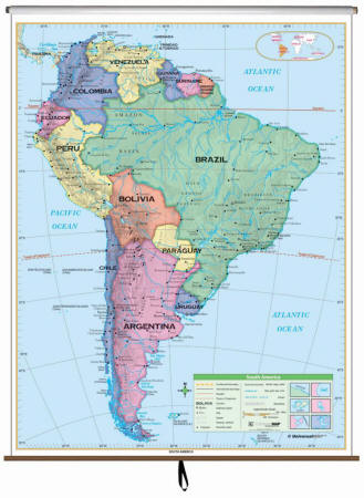 |
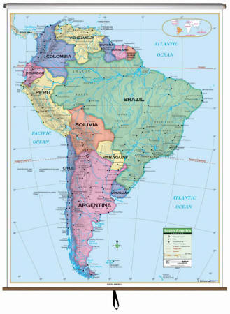
Item # KP28553 The South America Essential Classroom Wall Map includes Venezuela, Guyana, Surinam, French Guiana, Brazil, Columbia, Ecuador, Bolivia, Chile, Paraguay, Uruguay, and Argentina. Shaded relief highlights physical features of the continent. Appropriate for grades 4-8. Map will be printed on 64"W by 54"H sheet to match all other maps in the custom made map-set. Order Custom Wall Map Set here
|
|
Item # KP24385 The South America Primary Classroom Wall Map features a laminated surface that is both markable and washable. Details include all national capitols, national boundaries, the Tropic of Capricorn, cities, lines of latitude and longitude, the Equator, color-coded counties, and mountain peaks. Mounted on roller. Map will be printed on 64"W by 54"H sheet to match all other maps in the custom made map-set. Order Custom Wall Map Set here
|
Call us toll-free 877-822-9889 or 812-333-2772 for orders/questions Mon.-Sat. 10:00 am-5:30 pm Eastern Standard Time
Maps of Europe - 64"W x 54"H |
|
 |
Item # KP27941 The Europe Advanced Political Boundaries Classroom Wall Map features a wealth of valuable information, including country and state boundaries, as well as capitals, major waterways, and major cities. Created with legibility in mind, this brightly colored up to date map highlight the continent with detailed cartography, is easy to read, printed on tough non-tear material, and is markable. Mounted on roller. Appropriate for grades 6-12, satisfies state and national curriculum standards. This product is ideal for public, private, parochial, and home schools. Order Custom Wall Map Set here
|
 |
Item # KP27935 The Europe Advanced Physical Classroom Wall Map includes insets of Annual Rainfall, Energy-Manufacturing-Trade, Population Density, and Natural Vegetation and Environment. Featuring innovative shaded relief detail, this high quality series is appropriate for grades 6-12, and includes content that meets national and state curriculum standards. Four thematic inset maps enhance the value of the main map. Created with legibility in mind, this up to date map highlight the continent with detailed cartography, is easy to read, printed on tough non-tear material, and is markable. Mounted on roller. Order Custom Wall Map Set here
|
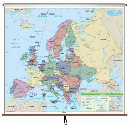 |
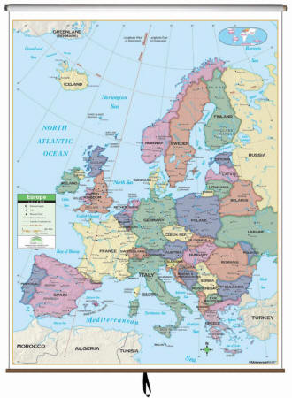
Item # KP28533 The Europe Essential Classroom Wall Map includes physical features and political boundaries, national capitals, cities, major waterways, and longitude/latitude lines; and all the European countries plus most of Russia, Iceland, Northern Africa, and northern Turkey. Shaded relief highlights physical features of the continent. Appropriate for grades 4-8. Order Custom Wall Map Set here
|
|
Item # KP24401 This Primary Classroom Wall Map of Europe by Universal Map features color-coded countries. The laminated surface makes it both markable and washable. Map will be printed on 64"W by 54"H sheet as all other maps in the custom made map-set. Map will be printed on 64"W by 54"H sheet to match all other maps in the custom made map-set. Order Custom Wall Map Set here
|
Call us toll-free 877-822-9889 or 812-333-2772 for orders/questions Mon.-Sat. 10:00 am-5:30 pm Eastern Standard Time
Maps of Australia - 64"W x 54"H |
|
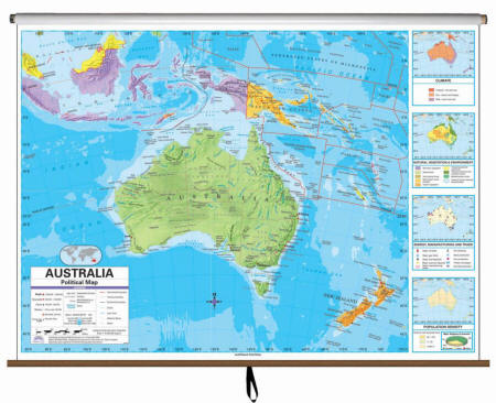 |
Item # KP27977 The Australia Advanced Political Classroom Wall Map features four insets: Climate; Energy, Manufacturing, and Trade; Population Density; and Natural Vegetation and Environment. Featuring a wealth of valuable information, including country and state boundaries, as well as capitals, major waterways, and major cities. Created with legibility in mind, these brightly colored maps highlight the continent with detailed cartography. Appropriate for grades 6-12, and satisfying state and national curriculum standards. Order Custom Wall Map Set here
|
 |
Item # KP27971 The Australia Advanced Physical Classroom Wall Map includes insets of Annual Rainfall, Energy-Manufacturing-Trade, Population Density, and Natural Vegetation and Environment. Featuring innovative shaded relief detail, this high quality series is appropriate for grades 6-12, and includes content that meets national and state curriculum standards. Four thematic inset maps enhance the value of the main map. Created with legibility in mind, this up to date map highlight the continent with detailed cartography, is easy to read, printed on tough non-tear material, and is markable. Mounted on roller. Order Custom Wall Map Set here
|
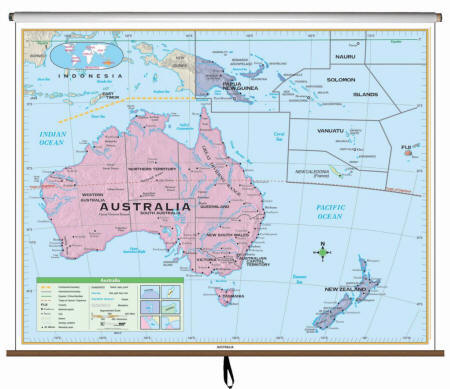 |
Item # KP28523 The Australia Essential Classroom Wall Map measures. Includes New Zealand, Papua New Guinea, Nauru, Solomon Islands, Vanuatu, New Caledonia, and Fiji. Mounted on roller. Appropriate for grades 4-8. Order Custom Wall Map Set here
|
|
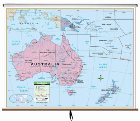
Item # KP24397 The Australia Primary Wall Map by Kappa Map Group is protected by a laminated surface, which is both markable and washable. The map has color-coded countries. The map’s area of coverage ranges north to Papua New Guinea, south to the Mediterranean Sea, east to Fiji, and west to the Indian Ocean. Details included are national capitals, national boundaries, the Tropic of Capricorn, cities, mountain peaks, and latitude and longitude lines. Mounted on roller. Order Custom Wall Map Set here
|
Call us toll-free 877-822-9889 or 812-333-2772 for orders/questions Mon.-Sat. 10:00 am-5:30 pm Eastern Standard Time
Maps of Middle East - 64"W x 54"H |
|
 |
Item #
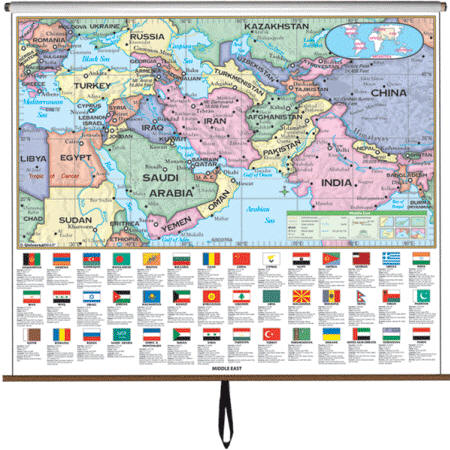
KP28573 The Middle East Essential Classroom Wall Map identifies 42 regional countries, plus lists specific country information and flags. The Essential Series features an enhanced legend and pictorial landform illustrations for intermediate level use. Also shows deserts & wetlands. Created with legibility in mind, this brightly colored up to date map highlight the Middle East with detailed cartography, is easy to read, printed on tough non-tear material, and is markable. Appropriate for grades 4 - 8, satisfies state and national curriculum standards. This product is ideal for public, private, parochial, and home schools. Order Custom Wall Map Set here
|
|
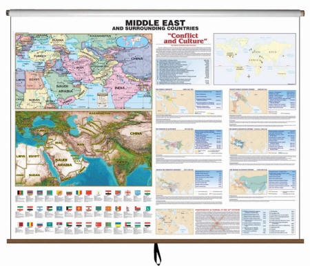
Item # KP26118 This is a pull down, spring rolled Middle East Historic Wall Map that identifies 42 regional countries. Below these regional maps, is a list of each country’s flag along with their statistics and country information. This edition features three sections noting the history of modern terrorism dating back to 1969, map insets and information on the many civilizations, empires, & kingdoms in the region dating back to 3500 B.C., and a section on the independence and turmoil in the Middle East in the 20th century beginning in 1917. Order Custom Wall Map Set here
|
Call us toll-free 877-822-9889 or 812-333-2772 for orders/questions Mon.-Sat. 10:00 am-5:30 pm Eastern Standard Time
Maps of Antarctica - 64"W x 54"H |
|
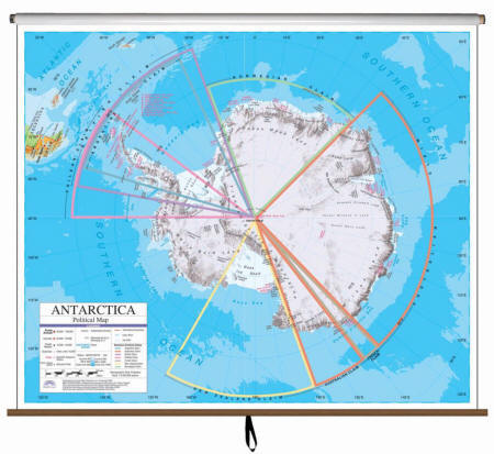 |
Item # KP27989 The Antarctica Advanced Political Classroom Wall Map features the claims by various countries of the world. Includes claims by New Zealand, Australia, France, Norway, plus others. Featuring a wealth of valuable information, including country and state boundaries, as well as capitals, major waterways, and major cities. Created with legibility in mind, these brightly colored maps highlight the continent with detailed cartography. Appropriate for grades 6-12, and satisfying state and national curriculum standards. Order Custom Wall Map Set here
|
|
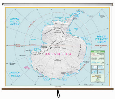
Item # KP28503 The Antarctica Essential Classroom Wall Map includes the Transantarctic Mountains, the south magnetic pole, the seas around Antarctica, and the lands named after the Antarctic explorers. Mounted on roller w and backboard. Features an enhanced legend and pictorial landform illustrations for intermediate level use. Also shows deserts & wetlands. The inset map locator illustrates the location of each continent in the world. Appropriate for grades 4 – 8. This product is ideal for public, private, parochial, and home schools. Order Custom Wall Map Set here
|
Call us toll-free 877-822-9889 or 812-333-2772 for orders/questions Mon.-Sat. 10:00 am-5:30 pm Eastern Standard Time
Maps of Canada - 64"W x 54"H |
|
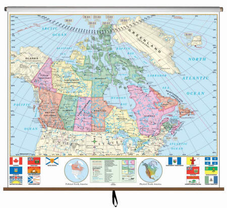 |
Item # KP28483 The Canada Essential Classroom Wall Map illustrates the 13 provinces and their flags, plus parts of surrounding countries. Measures 64″ x 54″. Mounted on roller. The Essential Series features an enhanced legend and pictorial landform illustrations for intermediate level use. Also shows deserts & wetlands. The inset map locator illustrates the location of each continent in the world. Appropriate for grades 4 – 8. This product is ideal for public, private, parochial, and home schools. Order Custom Wall Map Set here
|
|
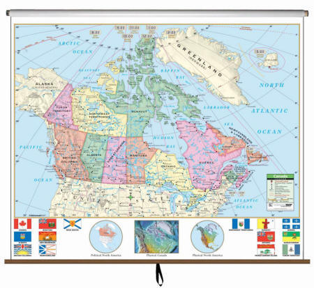
Item # KP23853 The Canada Primary Wall Map features province flags and North America inset maps. Measures 64″ x 54″. Multi-colored classroom wall maps help students identify political boundaries and national capitals. Physical landforms are shown in shaded relief. Classroom wall maps have a markable, washable-laminated surface. Mounted on roller. Order Custom Wall Map Set here
|
Call us toll-free 877-822-9889 or 812-333-2772 for orders/questions Mon.-Sat. 10:00 am-5:30 pm Eastern Standard Time
Maps of Central America - printed on 64"W x 54"H sheets |
|
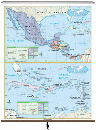 |
Item # KP28563 The Central America Essential Classroom Wall Map includes physical features and political boundaries, national capitals, cities, major waterways, and longitude/latitude lines; and Mexico, all of Central America, plus the Bahamas, Cuba, Haiti, Dominican Republic, Jamaica, the Leeward Islands, and the Lessser Antilles. Shaded relief highlights physical features of the continent. Appropriate for grades 4 – 8. Map will be printed on 64"W by 54"H sheet to match all other maps in the custom made map-set. Order Custom Wall Map Set here
|
|
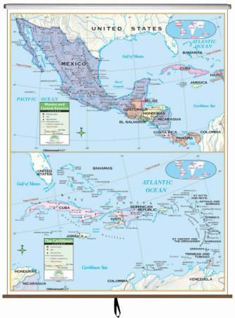
Item # KP24377 The Central America Primary Classroom Wall Map covers Central America, Mexico, and the Caribbean. The top portion of the map shows Central America and Mexico while the bottom portion shows the Caribbean. Map will be printed on 64"W by 54"H sheet to match all other maps in the custom made map-set. Order Custom Wall Map Set here
|
Call us toll-free 877-822-9889 or 812-333-2772 for orders/questions Mon.-Sat. 10:00 am-5:30 pm Eastern Standard Time
Historical Maps |
|
Call us toll-free 877-822-9889
or
812-333-2772 for a comprehensive list of US and/or
World History Maps. US History Wall Maps - 78 maps (range from 1500 to 1990) World History Maps - 68 maps (range from 10,000 BCE to 2002)
|
Miscellaneous Maps |
|
Many
additional maps include: individual US States, regional maps, county
maps, city maps, thematic maps and more.
Call us toll-free 877-822-9889 or 812-333-2772 for a comprehensive list.
|
* Multiple custom maps sets are mounted on a roller with backboard as seen in the illustration below.

** Flags and insets in some of the maps can be removed by special request.
|
Home | Products | About Us | Contact Us | Helpful Links | Return and Privacy Policies | Site Map | International Orders |
|||||||||||
|
|||||||||||
|
Site Map | Privacy Policy | Easy Return/Exchanges | APO/FPO Orders | No Minimum Order + FREE Shipping (contiguous USA) |
|||||||||||